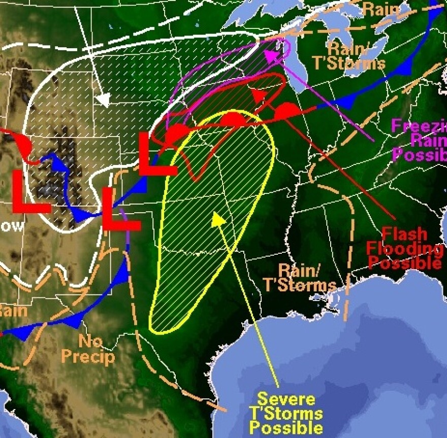
An elliptical shape closely resembling a snowshoe has been drawn by forecasters over a map of much of Missouri and Kansas, representing the chance for severe thunderstorms Tuesday night.
At late afternoon Tuesday, word from meteorologists is that hail is the most imminent threat to Kansas City and its region.
Hail for Kansas City, heavy snow for Nebraska and Northwest Kansas are prospects in the near weather future.
Senior Forecaster for the National Weather Service at Pleasant Hill Mike July expects thunderstorms sometime after 7 p.m., their strength tapering off toward midnight. He says other dynamics will reduce storm severity.
“I think the wind threat will be minimized and any tornadic threat is going to be greatly reduced as well,” he said.
July sees strong winds in one direction at 5,000 feet, another set moving at 25 to 30,000 feet, creating shear and thus, storms with hail, but mostly normal winds.
By later afternoon forecasters were tracking storms moving to the Northeast, up from Oklahoma.

